


lacreche-46km 650m

topolino
User
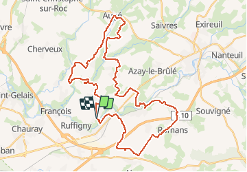

Length
46 km

Max alt
140 m

Uphill gradient
691 m
Km-Effort
56 km

Min alt
40 m

Downhill gradient
699 m
Boucle
Yes
Creation date :
2021-03-17 17:44:15.279
Updated on :
2021-03-17 17:47:15.263
--
Difficulty : Difficult

FREE GPS app for hiking
 SityTrail
IGN / Geographical institutes
SityTrail Plus
The world is yours!
About
Trail Mountain bike of 46 km to be discovered at New Aquitaine, Deux-Sèvres, La Crèche. This trail is proposed by topolino.
Positioning
Country:
France
Region :
New Aquitaine
Department/Province :
Deux-Sèvres
Municipality :
La Crèche
Location:
Unknown
Start:(Dec)
Start:(UTM)
707317 ; 5138495 (30T) N.
Comments